Overall, we know that the climate around Penang is tropical without extremely high temperatures. Days are very warm and often humid, while nights are fairly cool.
TEMPERATURE
For the temperature of the lake, we cannot calculate or analysis clearly due to the lack of the professional tool. But, we must understand that the Penang is a small island, so it has no large difference between the temperature of Lake Aman and the temperature of whole Penang.
According to World Climate and Weather Information, we can observe through the graph, Penang's temperature fluctuated around 22 to 32 °C. It more emphasized that the Penang is near the equator of the earth, it can be considered to be the hot tropical area.

Beside that, the process of lake breeze also contribute to the temperate around Tasik Aman. Basically, the lake breeze occurred like this way:
The lake breeze forms because Lake waters do not warm as quickly as the surrounding land surfaces.
Air cooled by contact with the cold lake waters is denser than that surrounding the lake and thus forms a cell of relatively high pressure over the lake.
When the sun heats the land, the air above it warms becoming less dense. Thus, solar heating produces a wide region of lower pressure over the land.
With high pressure over the lake and low pressure over land, the regional pressure gradient pushes winds inland off the lake.

Due to the occurence of lake breeze, the temperature around Lake Aman is maintained in a range and the wind flow around the atmosphere is very good.
CLIMATE, RAINFALL, AND HUMIDITY
According to the wikipedia, Penang enjoys a year-round tropical rainforest climate which is warm and sunny, along with plentiful rainfall, especially during the southwest monsoon from April to September. The climate is very much dictated by the surrounding sea and the wind system. Penang's proximity with Sumatra, Indonesia makes it susceptible to dust particles carried by wind from perennial but transient forest fires, creating a phenomenon known as the haze.

The table above showed the climate data of Penang( the souce from National Environment Agency and Hong Kong Observatory.)
Temperature (day) 27°C-30°C Temperature (night) 22°C-24°C
Ave annual rainfall 2670 mm Relative humidity 70%-90%
Windspeed
Wind speed is the speed of wind, the movement of air or other gases in an atmosphere. It is a scalar quantity, the magnitude of the vector of motion. wind speed, or wind velocity (when directionality is considered), is a fundamental abiotic factor that affects the growth and metabolism of many plant species.
Wind speed has always meant the movement of air in an outside environment, but the speed of air movement inside is important in many areas, including weather forecasting, aircraft and maritime operations, building and civil engineering. High wind speeds can cause unpleasant side effects, and strong winds often have special names, including gales, hurricanes, and typhoons.
Wind speed is measured with an anemometer and is affected by a number of factors and situations, operating on varying scales (from micro to macro scales). These include the pressure gradient, Rossby waves and jet streams, and local weather conditions.
Since I have no anemometer, so I just assumed that the wind speed around the Lake Aman is same as the wind speed in Penang, that is around 6km/h.

Wind and Wheather Statistic of Penang
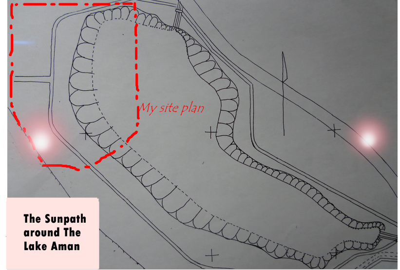
SUN PATH
Sun path refers to the apparent significant seasonal-and-hourly positional changes of the sun (and length of daylight) as the Earth rotates, and orbits around the sun. The relative position of the sun is a major factor in the heat gain of buildings and in the performance of solar energy systems. Accurate location-specific knowledge of sun path and climatic conditions is essential for economic decisions about solar collector area, orientation, landscaping, summer shading, and the cost-effective use of solar trackers.
Normally, the sun travel from east to west. So we can observe the sun path from the Lake Aman from the map below:


Sun Path Diagram of Penang
 Pondok
 Bridge
 Lamp around Lake Aman
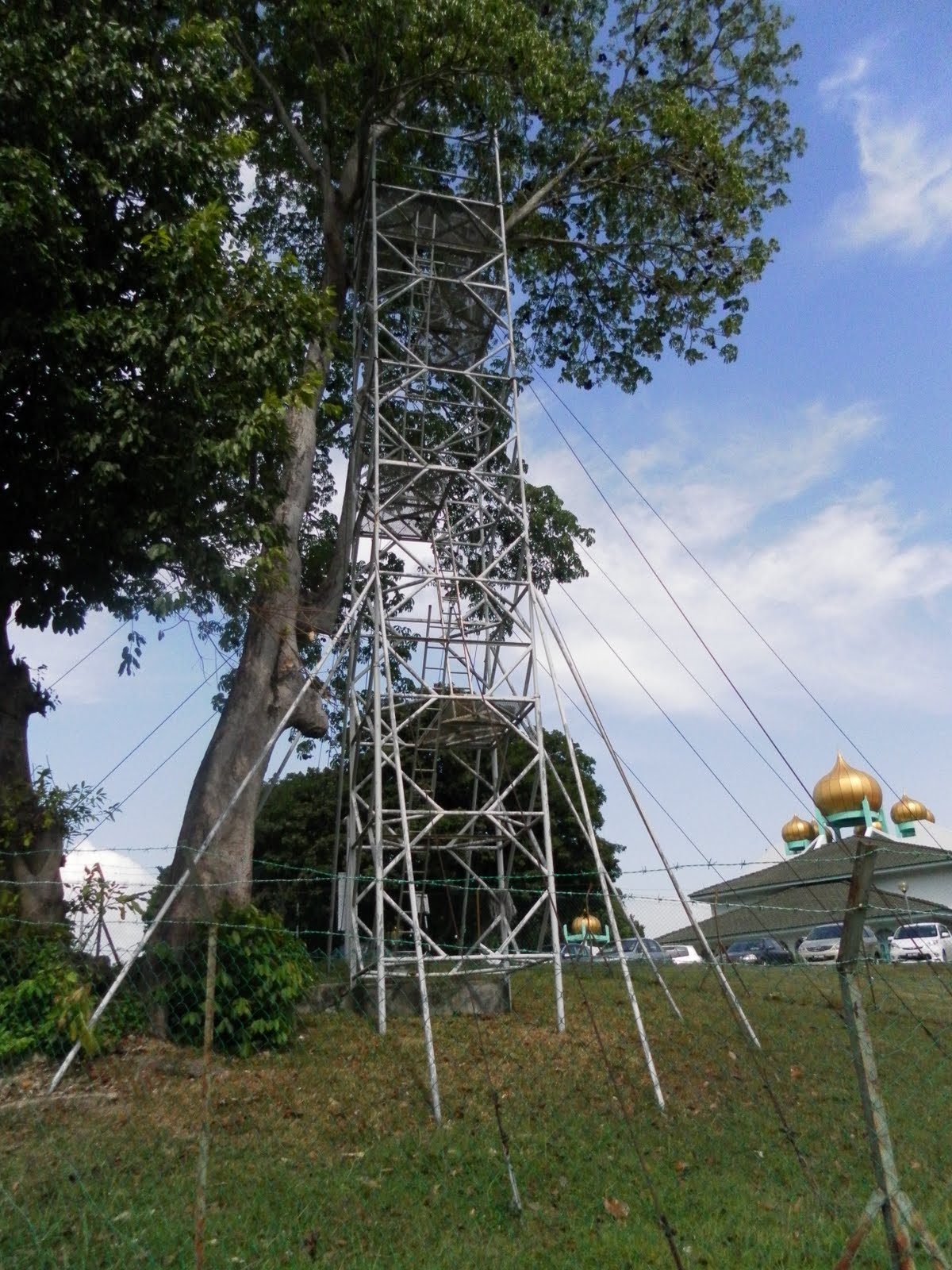 Flying Fox and Look up Tower
 Jogging Track
 KRU building for bycycles and canoes.
 Gym
Gym


