Monday, February 21, 2011

Project o4: Sense of Place ( Design on the Site)

What am I going to build in my site is Monster Motel which was designed last project before. I really like it, and decide to build a Monster Village in my site. Let me explain the concept of Monster Village.

Around Lake Aman, I planned to Build my Monster Motel in several units, as to attract the tourist to rest and relax at there. In the middle of the lake, I plant to build 2 activity hall, the people are have some event in activity hall.


Beside that, I also change some topography of my site. The purpose is to let the people more comfort when walk around the Lake Aman. Some facility also added For the convinience of the people. A large toilet are going to build beside the lake because the the toilet is not enough for the people for current status. The toilet of KRU building is always locked and dirty. The distance is also too long from Lake Aman.

My Monster Motel

For the monster motel, I modify a bit, to make it more spheric. The purpose is to calculate the area more easily.For the area, we can calcula

te by the formla of area of circle, the radius of the Monster Motel is around 4.2m. The calculation is shown by below:


A= π × 4.2m × 4.2m

A=55.41m2


The next pages will show you the arrangment of Monster Motel on the site:


Project o4: Sense of Place ( Circulation)

In the field of architecture, circulation refers to the way people move through and interact with a building.In public buildings, circulation is of high importance; for example, in buildings such as museums, it is key to have a floor plan that allows continuous movement while minimizing the necessity to retrace one's steps, allowing a visitor to see each work in a sequential, natural fashion. Structures such as elevators, escalators, and staircases are often referred to as circulation elements, as they are positioned and designed to optimize the flow of people through a building.


In design, the circulation of the building can be showed as below:


Beside that, The circulation also include the circulation of water in the lake Aman. The drainage system of the lake showed as the next pages:


Project o4: Sense of Place (Biodiversity)

We can see so many plants, animal and insect around the lake, they are so cute and indicated the situation of Lake Harapan which are not polluted yet. They are playing the vital role in the whole food chain around the Lake Aman.


The plants around the Lake Aman process the photosynthesis and provide the fresh air to the human and the animal. Some of the plant is tall enough and block all the direct sunlight, and it provide some shady place for student to rest. Temperature around the lake just can be controlled.Below showed some trees around the lake:


However, we also can observe some animal around the Lake Aman. They are important to each other with their connection. The lake is known for its quality marine life. The fish in the lake is the delicious food for lizard and the kingfisher. Each time when it overflows during the rainy season, fish are found in the monsoon drain in and round campus. For many, this is a time for a good catch.


Some of the people do not consider the animal in the lake and throw rubbish around it. The lizards had to look for food in the lake. This situation cause the amount of the lizard increase and out of control. Even some of the lizard had audacity to run after female passer-by.


Some insect also can be found around the lake also play their important role. For example, bee and the bee are the good flower pollinator. Without them, the plants cannot regenerate. Beside that, ant also be the recyclers, it eat the dead insect and animal. Sometimes, ants are essential to recycle dead tree. But, some pest like fly and mosquitor also spread some diseases and make the environment uncomfortable.

Project o4: Sense of Place ( Facilities and Building Around Lake Aman)

Around the Lake Aman, we can see the GYM, bridge, pavement, and lamp. All of them are so important to provide the convinience to the student in USM. Every evening, many student choose to jog or ride bicycle around the park. Of course, many young teenager like to use the facilities in the lake. Beside the the lake, we can see a house, which store the bicycle and canoe. Students are allowed to rent these facilities by using their metric card.


Pondok

Bridge

Lamp around Lake Aman

Flying Fox and Look up Tower

Jogging Track


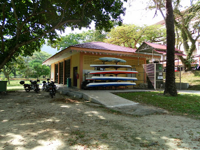
KRU building for bycycles and canoes.


Gym

Beside that, some signboard also can be found around the lake, which are “food and drinks are prohibited”, “not allow to swim at here”, “no angling” and “cycling through life”.


However,I still can observe some of the student break the rule. Some of the package of food are thrown around the lake and blocked the drainage system. Even some of them destroy the facility around the lake. Sometimes, it cause the water level is increase and flooding.


Project o4: Sense of Place (Topography)


Distribution of hills and major development projects on or above the 75m contour in Penang Island

Topography is the study of Earth's surface shape and features or those of planets, moons, and asteroids. It is also the description of such surface shapes and features (especially their depiction in maps).

The topography of an area can also mean the surface shape and features themselves.

In a broader sense, topography is concerned with local detail in general, including not only relief but also vegetative and human-made features, and even local history and culture. This meaning is less common in America, where topographic maps with elevation contours have made "topography" synonymous with relief. The older sense of topography as the study of place still has currency in Europe.

For the purposes of this article, topography specifically involves the recording of relief or terrain, the three-dimensional quality of the surface, and the identification of specific landforms. This is also known as geomorphometry. In modern usage, this involves generation of elevation data in electronic form. It is often considered to include the graphic representation of the landform on a map by a variety of techniques, including contour lines, Hypsometric tints, and relief shading.

USM is located around the flat land around the seaside. We can observed it from the map of the Penang. For its contour, it is below 75 m from sea level.

For the topography of Lake Aman, we can conclude that the land is flat and suitable for agriculture activities and housing area since the contours of the map have no large difference ( maintain around 10-25m from sea level).Of course, that is one of the reason that I choose the site around Lake Aman.


Project o4: Sense of Place (site)

Overall, we know that the climate around Penang is tropical without extremely high temperatures. Days are very warm and often humid, while nights are fairly cool.


TEMPERATURE

For the temperature of the lake, we cannot calculate or analysis clearly due to the lack of the professional tool. But, we must understand that the Penang is a small island, so it has no large difference between the temperature of Lake Aman and the temperature of whole Penang.


According to World Climate and Weather Information, we can observe through the graph, Penang's temperature fluctuated around 22 to 32 °C. It more emphasized that the Penang is near the equator of the earth, it can be considered to be the hot tropical area.


Beside that, the process of lake breeze also contribute to the temperate around Tasik Aman. Basically, the lake breeze occurred like this way:


  1. The lake breeze forms because Lake waters do not warm as quickly as the surrounding land surfaces.

  2. Air cooled by contact with the cold lake waters is denser than that surrounding the lake and thus forms a cell of relatively high pressure over the lake.

  3. When the sun heats the land, the air above it warms becoming less dense. Thus, solar heating produces a wide region of lower pressure over the land.

  4. With high pressure over the lake and low pressure over land, the regional pressure gradient pushes winds inland off the lake.

Due to the occurence of lake breeze, the temperature around Lake Aman is maintained in a range and the wind flow around the atmosphere is very good.


CLIMATE, RAINFALL, AND HUMIDITY


According to the wikipedia, Penang enjoys a year-round tropical rainforest climate which is warm and sunny, along with plentiful rainfall, especially during the southwest monsoon from April to September. The climate is very much dictated by the surrounding sea and the wind system. Penang's proximity with Sumatra, Indonesia makes it susceptible to dust particles carried by wind from perennial but transient forest fires, creating a phenomenon known as the haze.


The table above showed the climate data of Penang( the souce from National Environment Agency and Hong Kong Observatory.)


    Temperature (day) 27°C-30°C Temperature (night) 22°C-24°C

    Ave annual rainfall 2670 mm Relative humidity 70%-90%


Windspeed


Wind speed is the speed of wind, the movement of air or other gases in an atmosphere. It is a scalar quantity, the magnitude of the vector of motion. wind speed, or wind velocity (when directionality is considered), is a fundamental abiotic factor that affects the growth and metabolism of many plant species.


Wind speed has always meant the movement of air in an outside environment, but the speed of air movement inside is important in many areas, including weather forecasting, aircraft and maritime operations, building and civil engineering. High wind speeds can cause unpleasant side effects, and strong winds often have special names, including gales, hurricanes, and typhoons.


Wind speed is measured with an anemometer and is affected by a number of factors and situations, operating on varying scales (from micro to macro scales). These include the pressure gradient, Rossby waves and jet streams, and local weather conditions.


Since I have no anemometer, so I just assumed that the wind speed around the Lake Aman is same as the wind speed in Penang, that is around 6km/h.


Wind and Wheather Statistic of Penang


SUN PATH


Sun path refers to the apparent significant seasonal-and-hourly positional changes of the sun (and length of daylight) as the Earth rotates, and orbits around the sun. The relative position of the sun is a major factor in the heat gain of buildings and in the performance of solar energy systems. Accurate location-specific knowledge of sun path and climatic conditions is essential for economic decisions about solar collector area, orientation, landscaping, summer shading, and the cost-effective use of solar trackers.


Normally, the sun travel from east to west. So we can observe the sun path from the Lake Aman from the map below:


Sun Path Diagram of Penang

Project o4: Sense of Place (Location)

The lecturer had set the requirement, our site must be in the area of USM. I considered so many places. I decided to set my model- Monster Motel around the Lake Aman in USM.


The first concept is, my model must be in a peace environment because it is a motel, for the purpose for people to rest and take a shower. Lake Aman is an ideal and perfect place for my motel, since it is peace and adorable place for the teenage to exercise and jog.

Beside that, there many flora and fauna exist around there. It showed the balance of the ecology, the relationship between the human being and the animal is in harmony state.


Project o4: Sense of Place ( introduction)

In Project 04: Sense Of Place, we are given the task to identify a suitable location to place the outcome of Project of Project 03 on any particular site on any particular site on USM Main Campus. We need to get site information to be analyzed. The information must be cover every environmental aspects of the site like location, topography, prevailing wind direction, sun path and site potential.


We have to generate an A4-size report that provides information related to the selected sites. The report shall contain the Key Plan, Location Plan and Site Plan, as well as other relevant data that can provide complete information on the selected site.


For the Plan of USM, we found in 2 place: Development Department of USM and IT lab of Housing, Building and Planning School. Most of us face some problem of the size of plan. The size of the plan is too large and we have to zoom into A3 size.

Most of the Information, I search for internet. Beside that, we had to visit to our site and observe around the site. Meanwhile, we also have to take some photo for evidence of report.


In this project, I have to draw the site plan and the section elevation of my site. Many measurement have to be made to made diagram more clear. At the end of the project, I learned the basic knowledge of preparing a report for a particular project site. Aspect of technical drawing and writing are exposed by me in this project.


Saturday, February 5, 2011

Project03- Monster Motel (03)


Then, I rush for my board~~ haiz!! CNY holiday is not enough for me .... (T^T)

Tuesday, February 1, 2011

Project03- Monster Motel (02)


I changed my idea to use paper clay to make it, and thanks God! It is successful already. Then I made it with the helping hand of my little brother.